Karel KRIZ

Cartographer & GIScientist
My name is Karel Kriz and I am a professor for cartography and geoinformation science at the University of Vienna, Austria. I am currently working at the Department of Geography and Regional Research. My main areas of interest lie in cartographic design, web-based cartography, GIScience and thematic aspects of mountain cartography.
Besides working in an academic environment, lecturing, dealing with maps and writing papers I love to explore the mountains in the winter on skis and in the summer on a MTB of course always with a map and GPS. Feel free to contact me if you have any questions!
Education
Doctor of Science
University of Vienna, AustriaMaster of Science
University of Vienna, AustriaGeography and Cartography
University of Vienna, AustriaComputer Science and Atmospheric Science
University of Illinois, USAProfessional Experience
Lecturer for Geokommunikation, Cartography and GIS
Teacher Education, phBurgenland, AustriaLecturer for Geokommunikation, Cartography and GIS
ÖRISK - Risk Prevention and Disaster Management, Postgraduate Centre, University of Vienna, AustriaAssistant Professor
University of Vienna, AustriaEvaluator
SNF Swiss National Science FoundationGACR Czech Science Foundation
Editorial Board
Cartographic JournalSeries Lecture Notes in Geoinformation and Cartography
Lecturer for Geokommunikation, Cartography and GIS
University of Vienna, AustriaEditor in Chief (with Kainz, Riedl)
Wiener Schriften zur Geographie und KartographieInternational workshops and map exhibitions
Organization and realizationVisiting Scholar
SDSU San Diego, USAVisiting Scholar
RMIT Melbourne, AustraliaVisiting Scholar
University of Victoria, CanadaConsultant
Academy of Science, CubaResearch Assistant
University of Vienna, AustriaFreelance Cartographer
System Administration, Programming, Mapping, GISAffiliations
International Cartographic Association
Chair of the Commission on Mountain CartographyAustrian National Delegate
Austrian Cartographic Commission
Chair of the Commission on High Mountain CartographyResponsible for foreign affairs
Membership
Austrian Geographic SocietyAustrian Cartographic Society
German Cartographic Society
International Advisory Board GIS Brno, Czech Republic
Scientific advisory board Hydrological Atlas of Austria Member of CIRDIS (Center for Interdisciplinary Research and Documentation of Inner and South Asian Cultural History)
Faculty Member
Initiativkolleg - Cultural Transfers and Cross-Contacts in the Himalayan BorderlandsKey Interests
Cartography can be seen as the art and science of making maps!Karel Kriz
Personal Interests
Selected Publications since 2007
Selected Scientific Presentations since 2007
Media Collections Carto YouTube Channel
2024-03-21 TM Wissen ServusTV
2024-03-14 Hölzel Journal
2022-01-22 DiePresse
2021-10-01 Karten Autotouring
2021-10-01 Falter Heureka
2021-07-27 ÖWM Kurier
Audio Collections 2023-11-28 Ö3 Macht der Karten
2023-11-28 Ö1 Macht der Karten
2020-08-12 Ö1 Morgenjournal
2020-08-12 Ö3 Morgenjournal
2017-05-03 Ö1 Dimensionen
2011-02-04 Ö1 Von Tag zu Tag
2009-03-01 Ö1 KinderUni
Selected Projects
- VIRUS atlas
- Riedenkarten AT - Vineyard Maps of Austria
- ALBINA
- ÖROK-Atlas online
- LAWIS - Avalanche Warning Services Information System
- DPP - Digitising Patterns of Power
- WISER - Water Isotope System for data analysis, visualization and Electronic Retrieval
- Cultural History of the Western Himalaya from the 8th Century
- Hydrological Atlas of Austria
- berg&karte Skitouring Plattform
VIRUS atlas
VIRUS atlas is a project conducted at the University of Vienna, Department of Geography and Regional Research, Cartography and Geoinformation Working Group, with goal to communicate relevant spatio-temporal topics for Austria by means of maps. In the current case, information on COVID-19 as well as selected topics on the labour market and demography are integrated. For this purpose, new innovative cartographic representations are being developed to make current themes visible at a glance. The aim of the project is to provide the interested public as well as decision makers with an instrument to better assess current risk situations in Austria.
VIRUS atlas
Riedenkarten AT - Vineyard Maps of Austria
Riedenkarten AT is a research and development project with the aim of conceiving a functional as well as user-centered geographic information portal of all Austrian vineyards to record, represent and communicate relevant factors dealing with wine and their spatial-temporal characteristics. Österreich Wein Marketing GmbH (ÖWM) commissioned the project in close cooperation with the University of Vienna, the Institute of Geography and Regional Research and the Technical Office for Landscape Planning plan+land, Artner & Tomasits OG.
Homepage Riedenkarten AT
austrianvineyards.com
riedenkarten.at
Promotion Video (en)
ALBINA
ALBINA is project that has the goal to produce a joint, multilingual avalanche bulletin, which informs the public daily about the avalanche situation in the entire European region of Tyrol, South Tyrol and Trentino and is implemented as part of an Interreg V-A Italy-Austria project. The developed communication structures will promote and facilitate the exchange of information between the experts of the different regions. They are supported by a software system that visualizes weather station data, observations, snow profiles and avalanche events of the entire region and offers the possibility to enter the avalanche bulletin.
ALBINA
avalanche.report
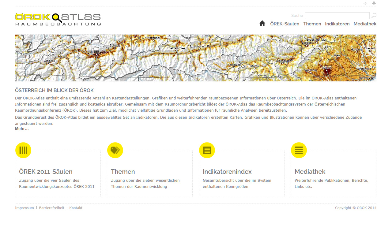
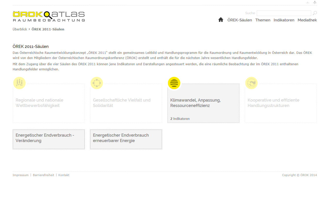
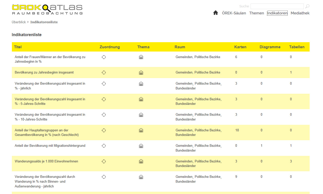
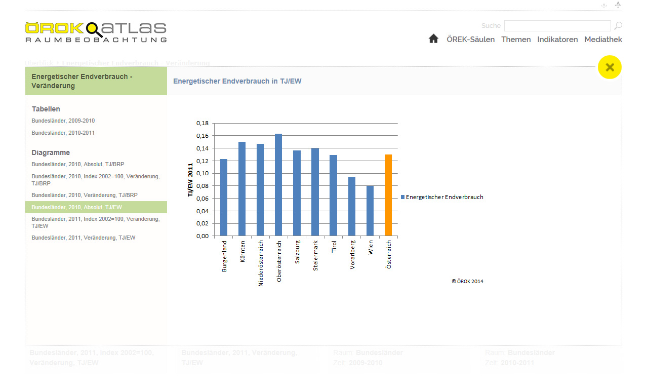
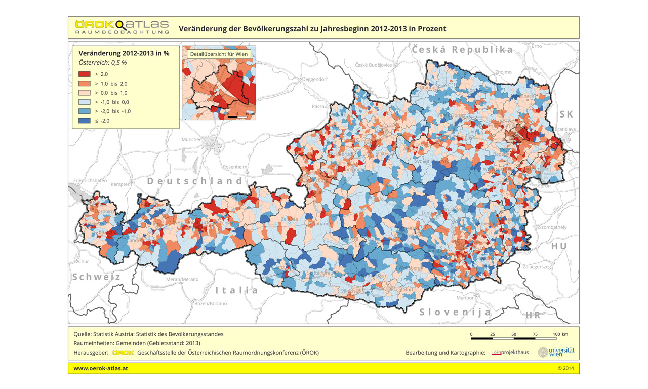
ÖROK-Atlas online
ÖROK-Atlas online is a cooperative scientific project with the goal of developing an online system that enables the user to explore national (Austrian) as well as international (European) statistical information. Users can compare and analyze data and visualize the selected information in a high-quality cartographic environment. ÖROK-Atlas online is a synthesis of Cartography, Geographic Information Technology, Multimedia and Statistical Analysis.
www.oerok-atlas.at
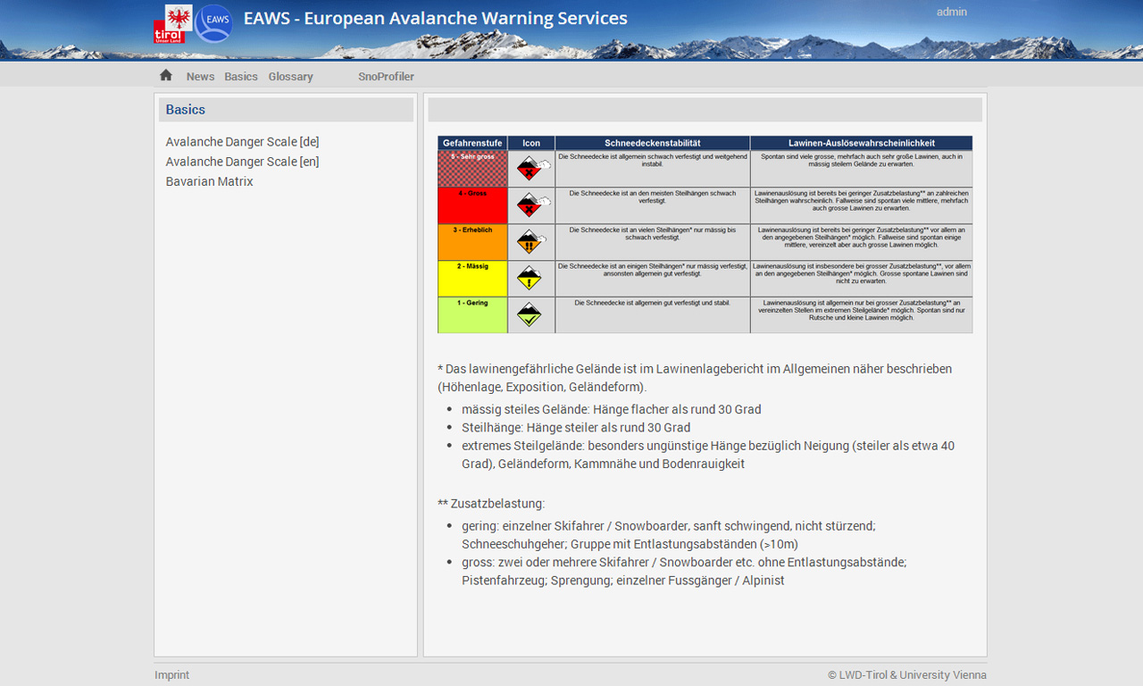
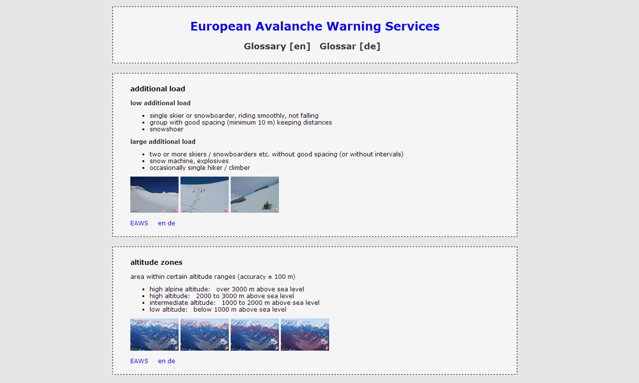
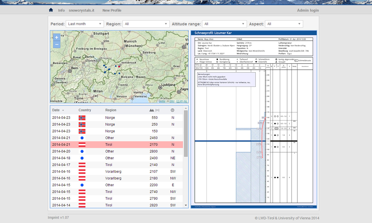
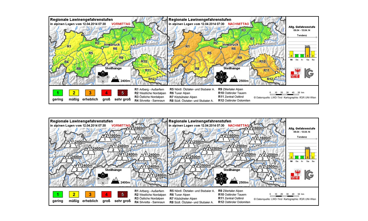
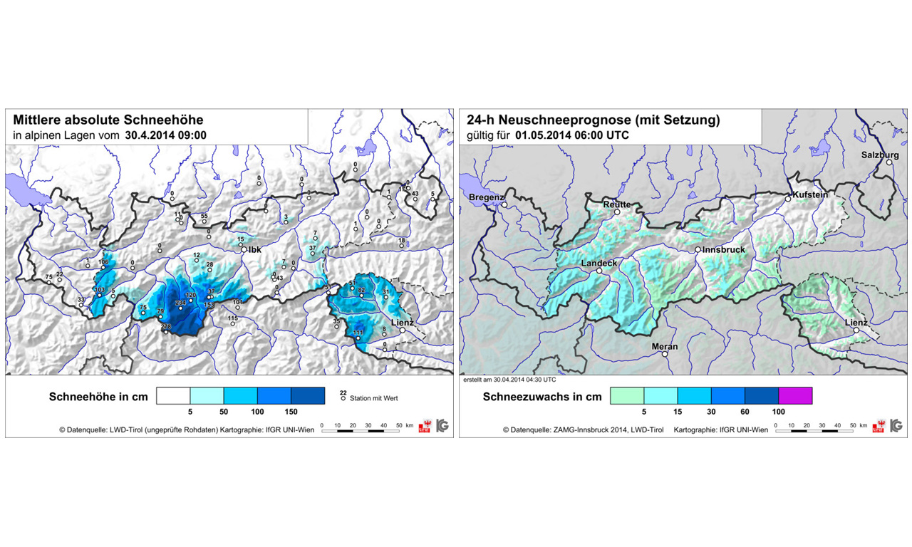
LAWIS - Avalanche Warning Services Information System
The goal of this cooperation project between the Austrian Avalanche Warning Services and the University of Vienna, Department of Geography and Regional Research is to develop and maintain a complex and very powerful database driven online system embedded within a geo-spatial visualization environment for access of current relevant avalanche information in Europe. Besides the direct link to all European Avalanche Warning Centres with their daily information bulletins further lexical as well as current facts concerning weather, avalanches, snow profiles and mountain casualties are integrated and made accessible.
LAWIS
DPP - Digitising Patterns of Power
Digitising Patterns of Power (DPP) is a multidisciplinary project, conducted by the Austrian Academy of Sciences the Institute for Medieval Research (IMAFO) in cooperation with the University of Vienna, Department of Geography and Regional Research. It is part of an initiative to promote digital humanities research in Austria. DPP brings together expertise from historical and archaeological research as well as Digital Humanities in the field of spatial representation and geo-communication to explore medieval geographies.
DPP Homepage
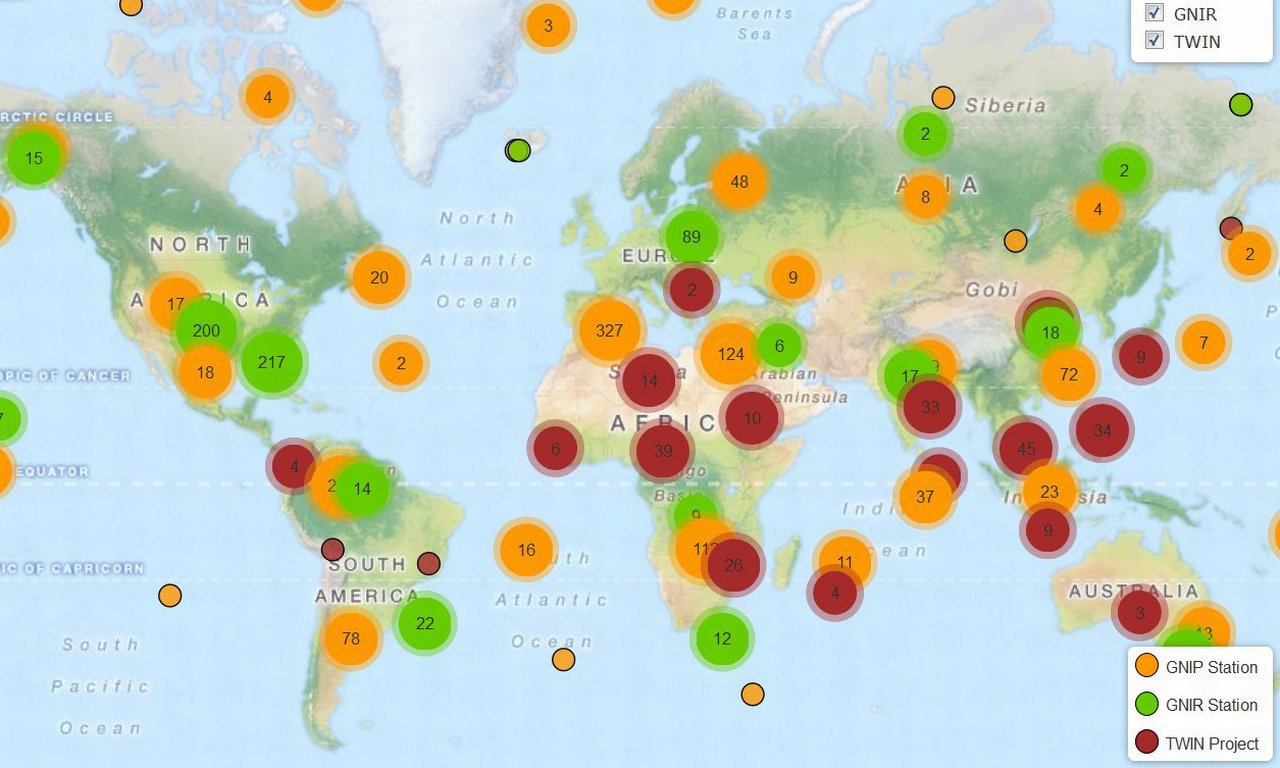
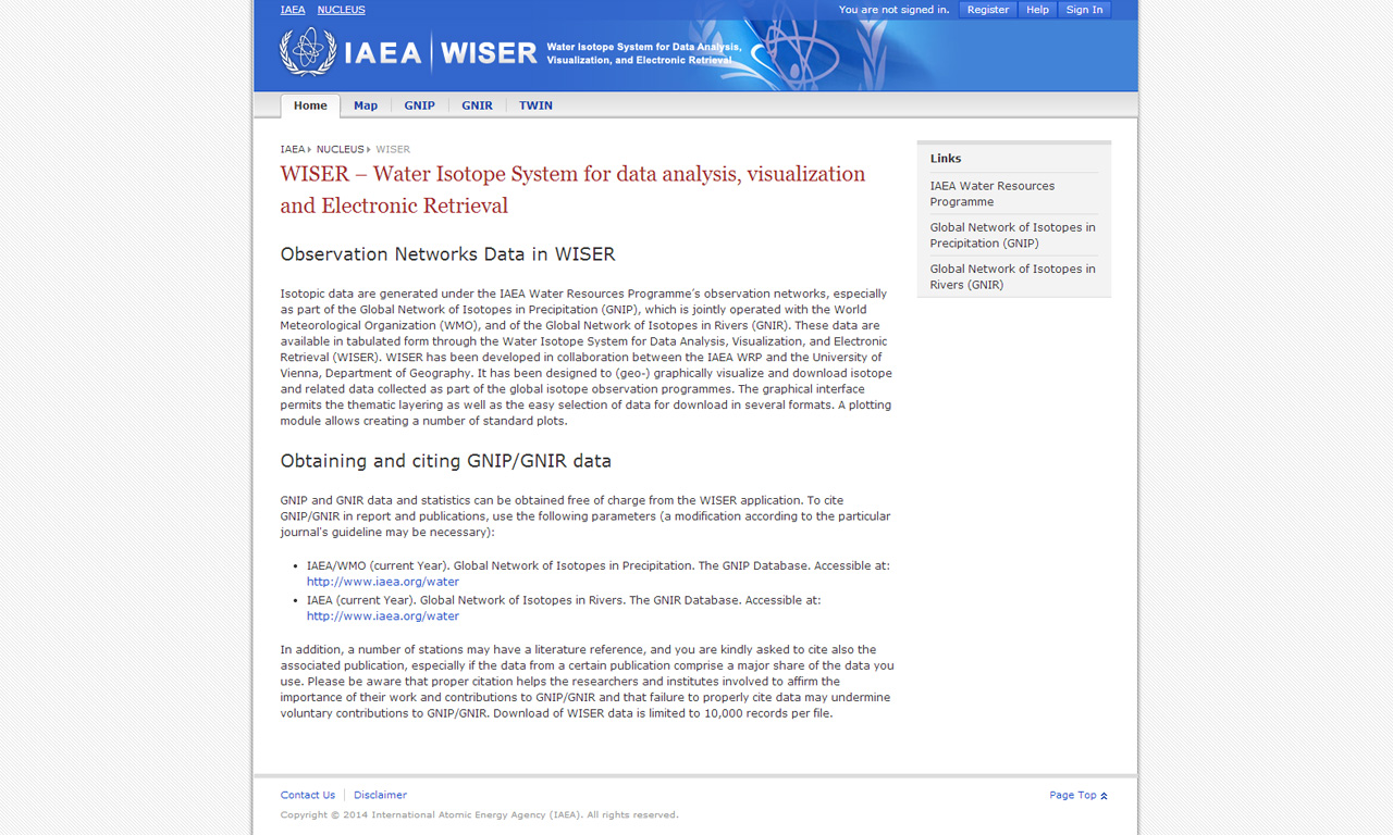
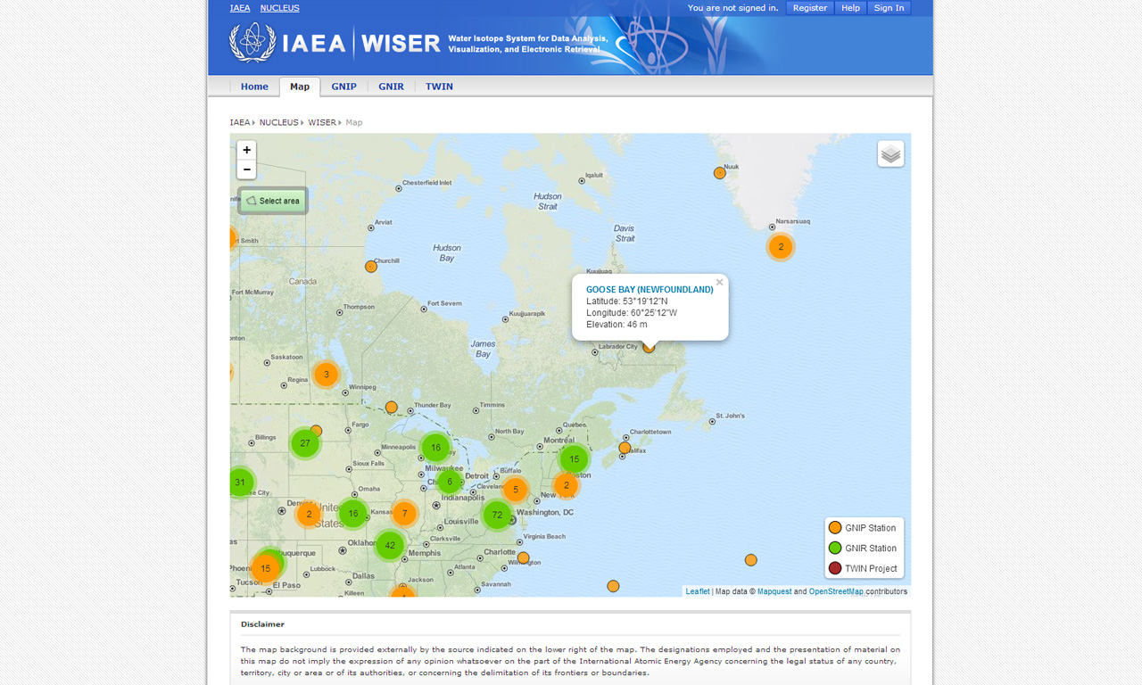
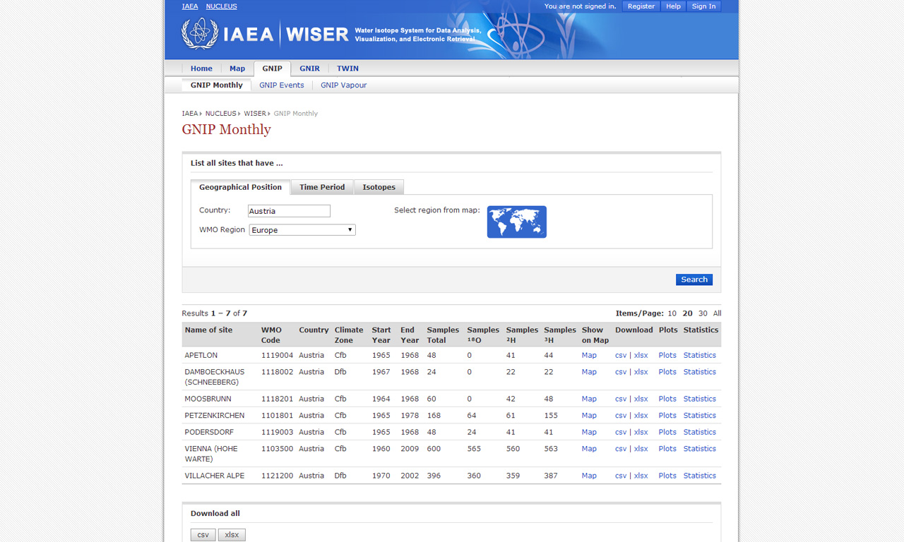
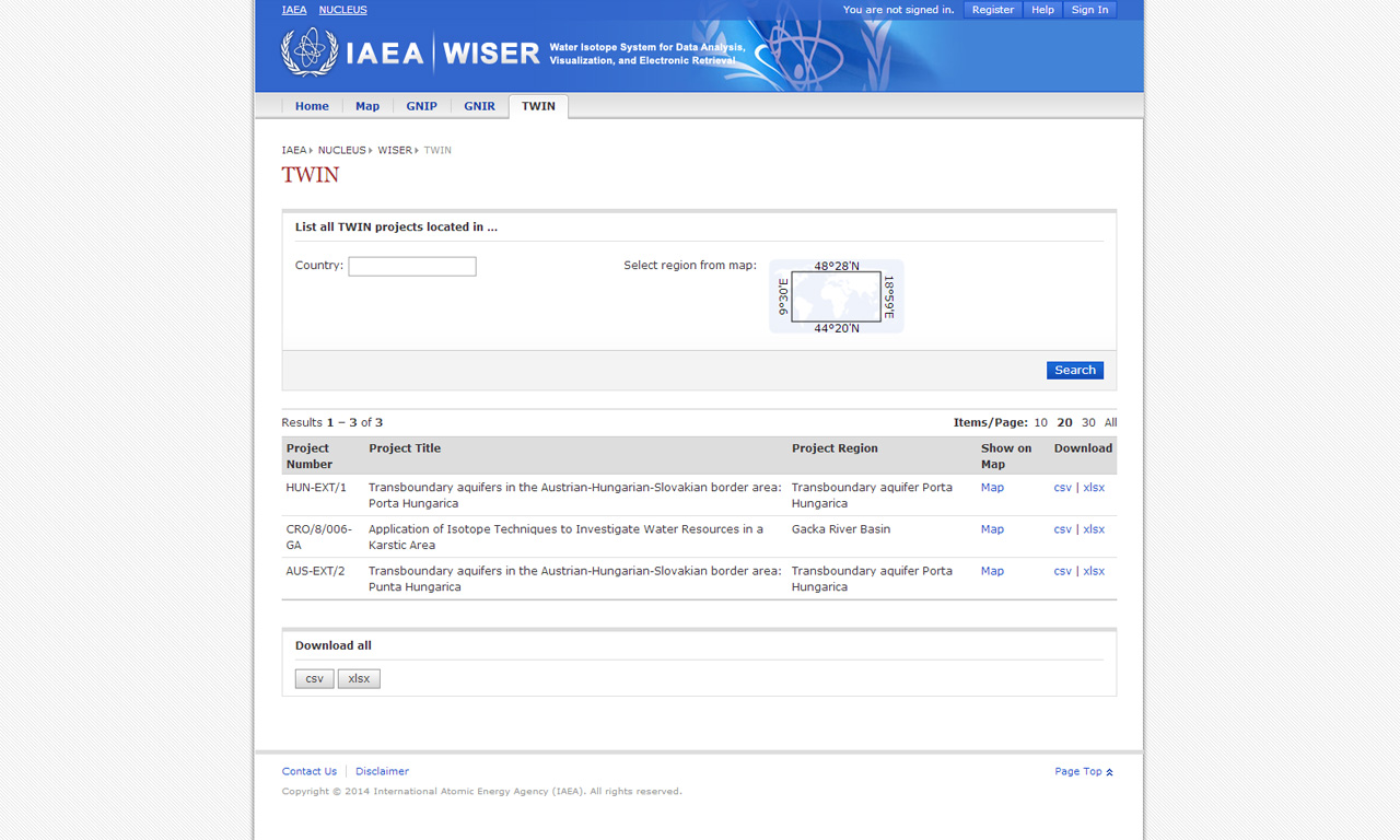
WISER - Water Isotope System and Electronic Retrieval
Isotopic data are generated under the IAEA Water Resources Programme's observation networks, especially as part of the Global Network of Isotopes in Precipitation (GNIP), which is jointly operated with the World Meteorological Organization (WMO), and of the Global Network of Isotopes in Rivers (GNIR). These data are available in tabulated form through the Water Isotope System for Data Analysis, Visualization, and Electronic Retrieval (WISER). WISER has been developed in collaboration between the IAEA WRP and the University of Vienna, Department of Geography. It has been designed to (geo-) graphically visualize and download isotope and related data collected as part of the global isotope observation programmes. The graphical interface permits the thematic layering as well as the easy selection of data for download in several formats. A plotting module allows creating a number of standard plots.
IAEA Water Resources Programme
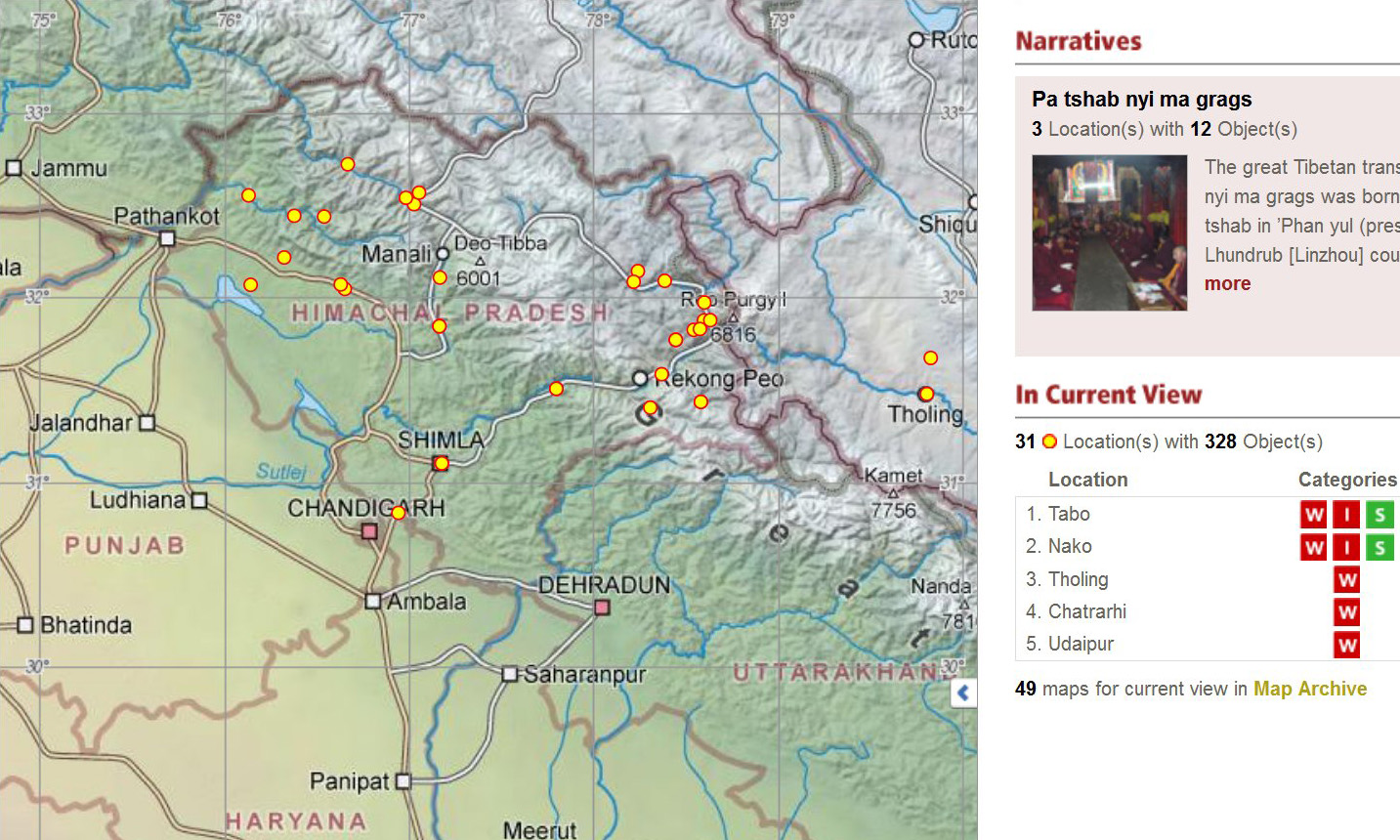
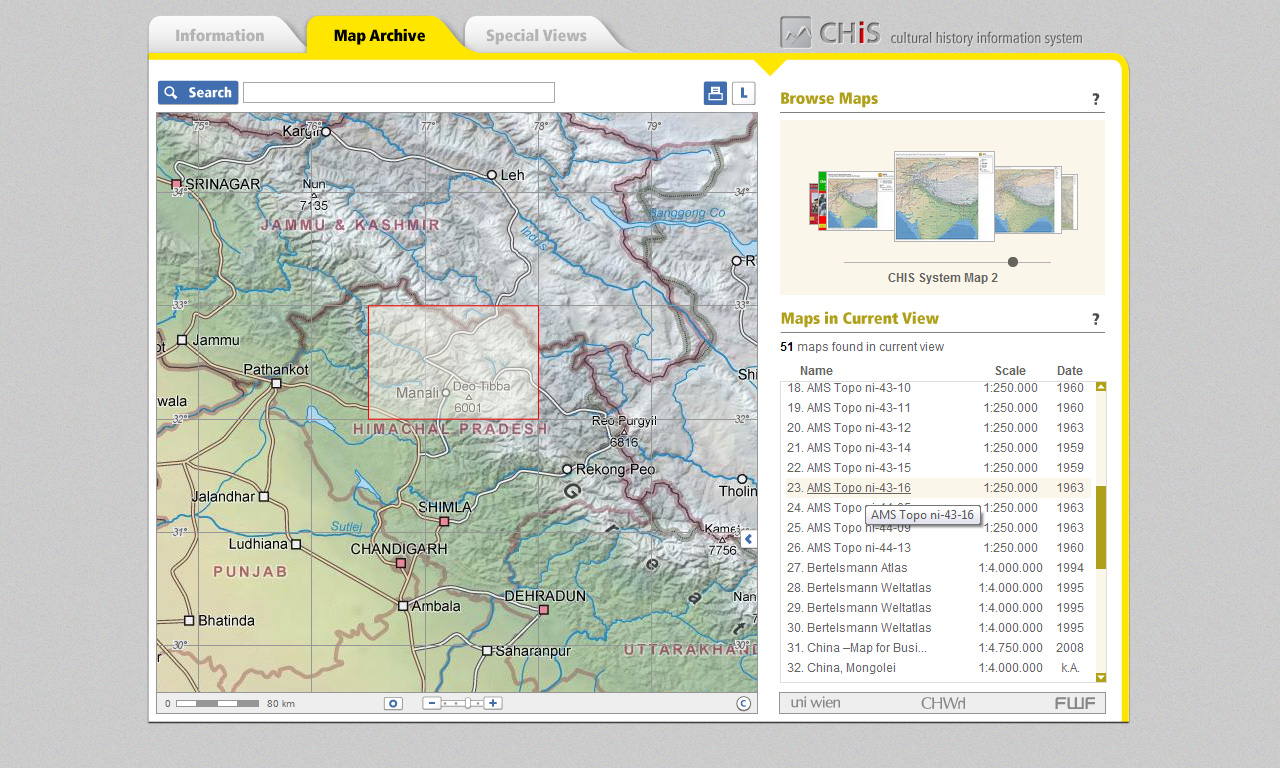
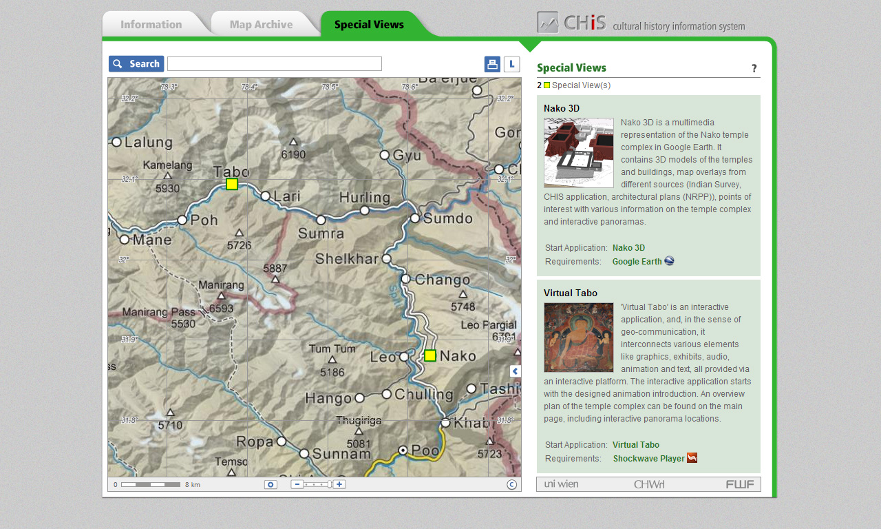
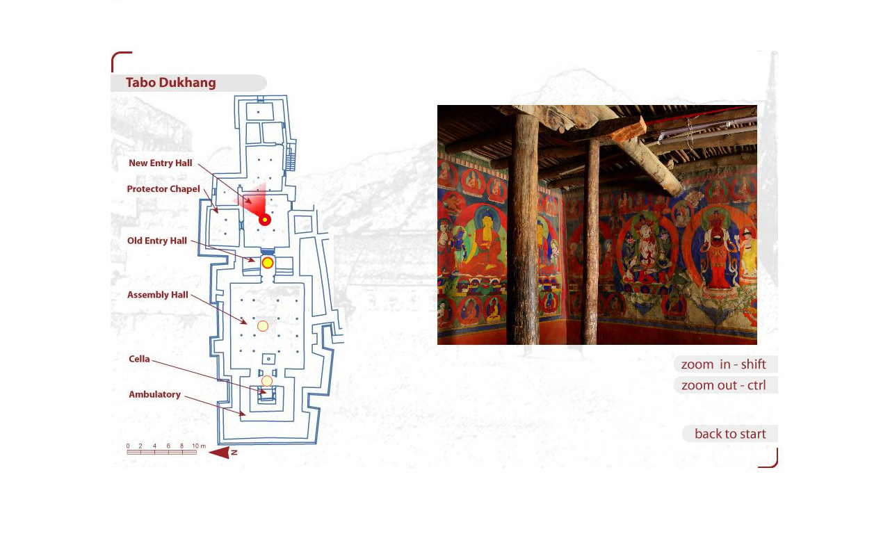
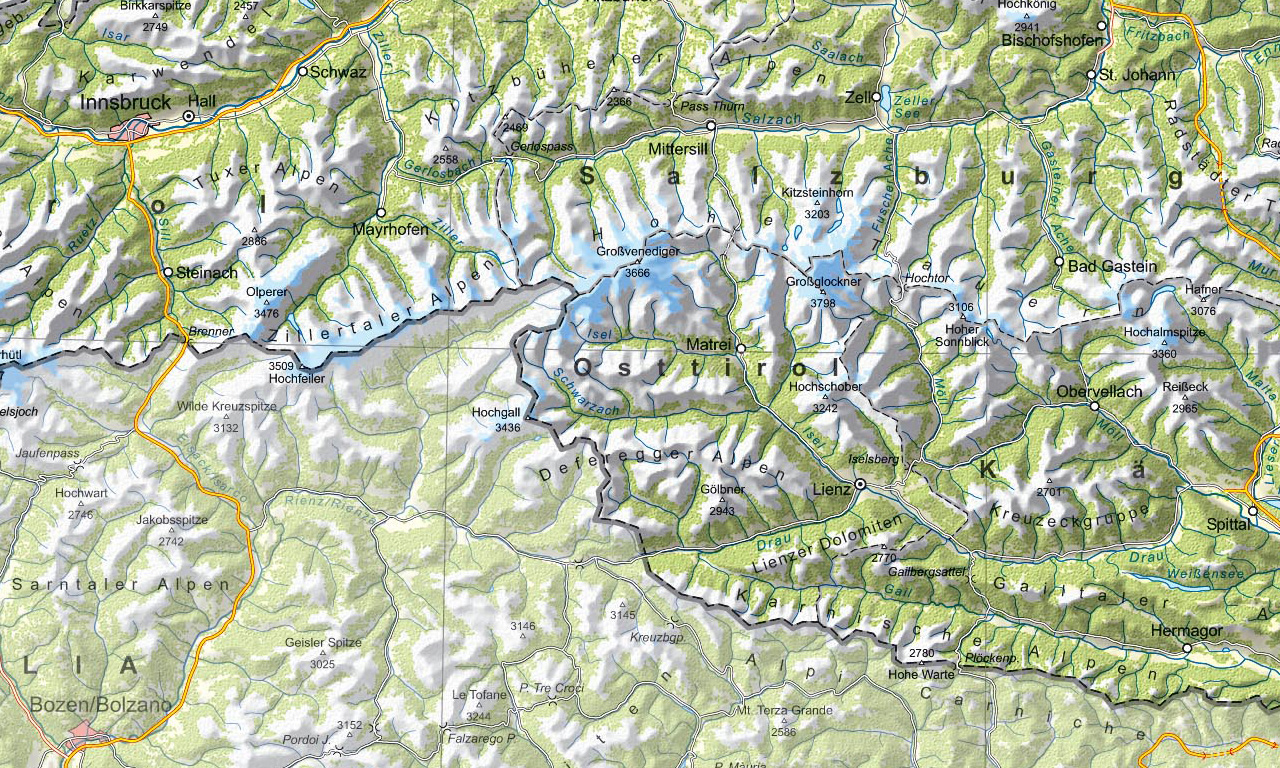
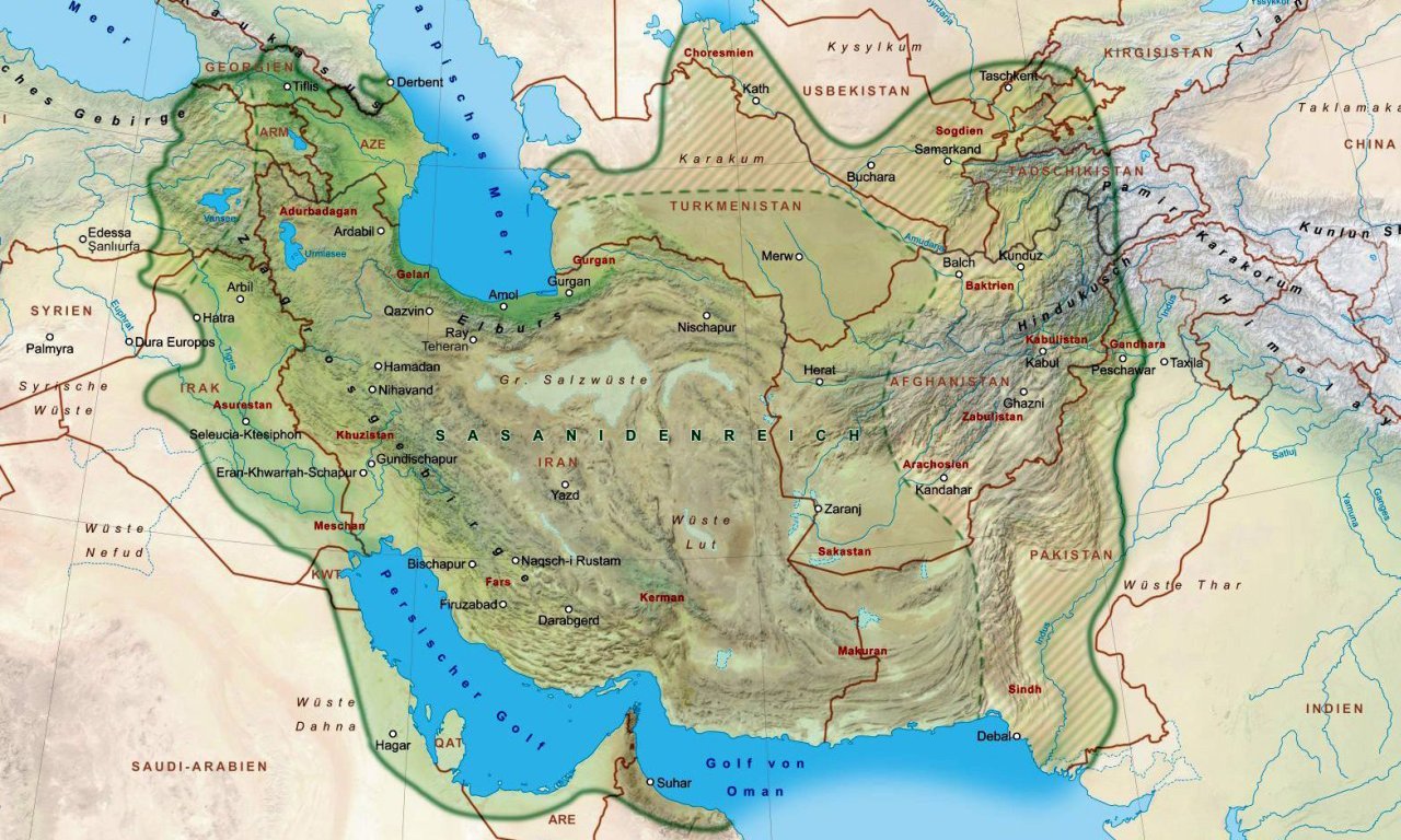
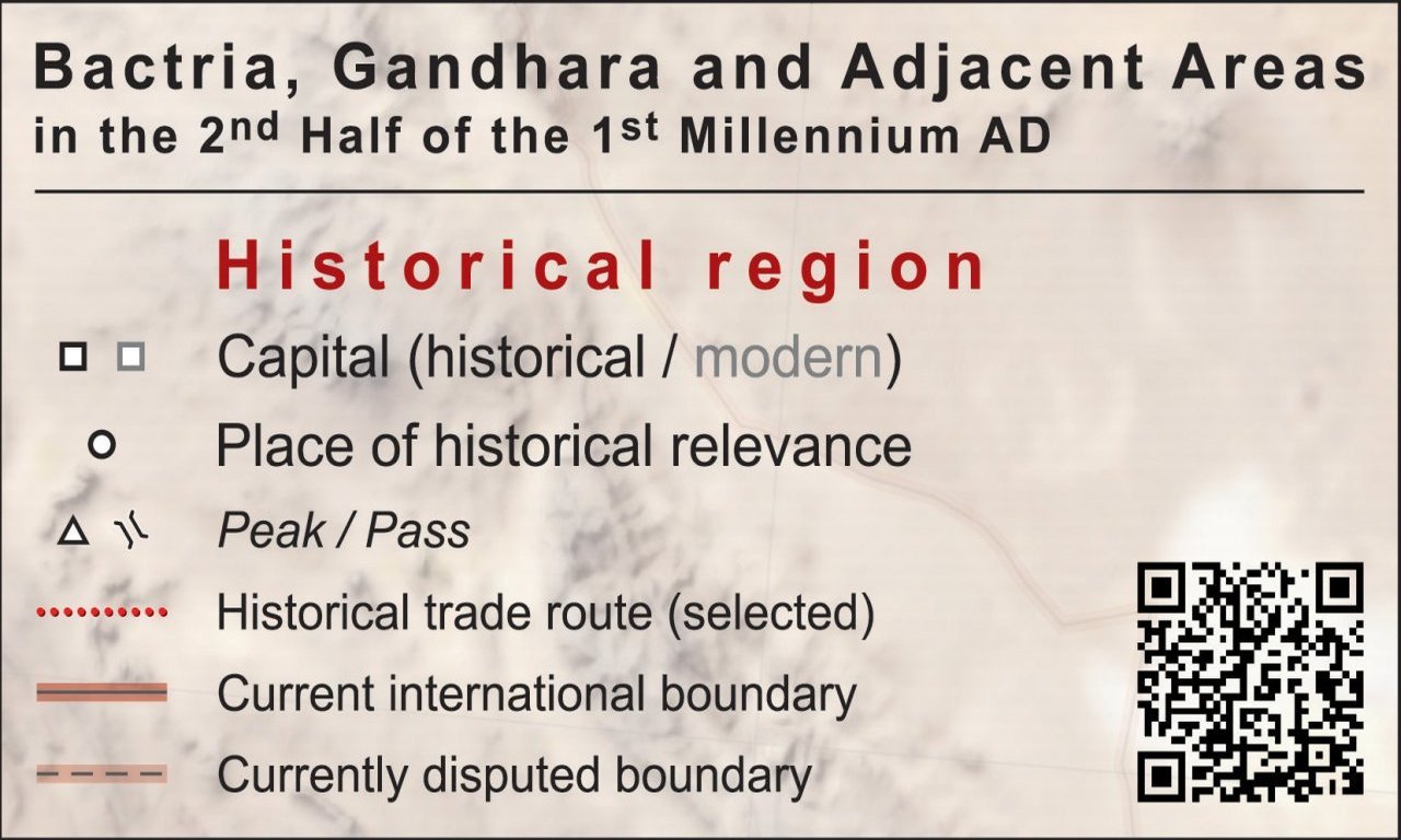
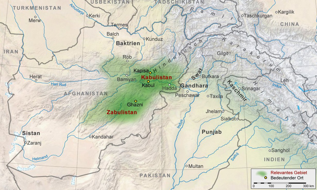
Cultural History of the Western Himalaya from the 8th Century
The purpose of the National Research Network (NFN) The Cultural History of the Western Himalaya from the 8th Century (S 98 NFN) is to facilitate the documentation and descriptive analysis of the rapidly disappearing cultures of the Western Himalaya in order to study, with a comparative method and from different disciplinary perspectives, the manifold facets of the cultures in their several contexts. The goal is a high quality cartographic output based on a digital/analogue concept which allows the viewer to derive a holistic view of the entire data produced through the different sub-projects of the NFN in a regional, cultural, and historical context.
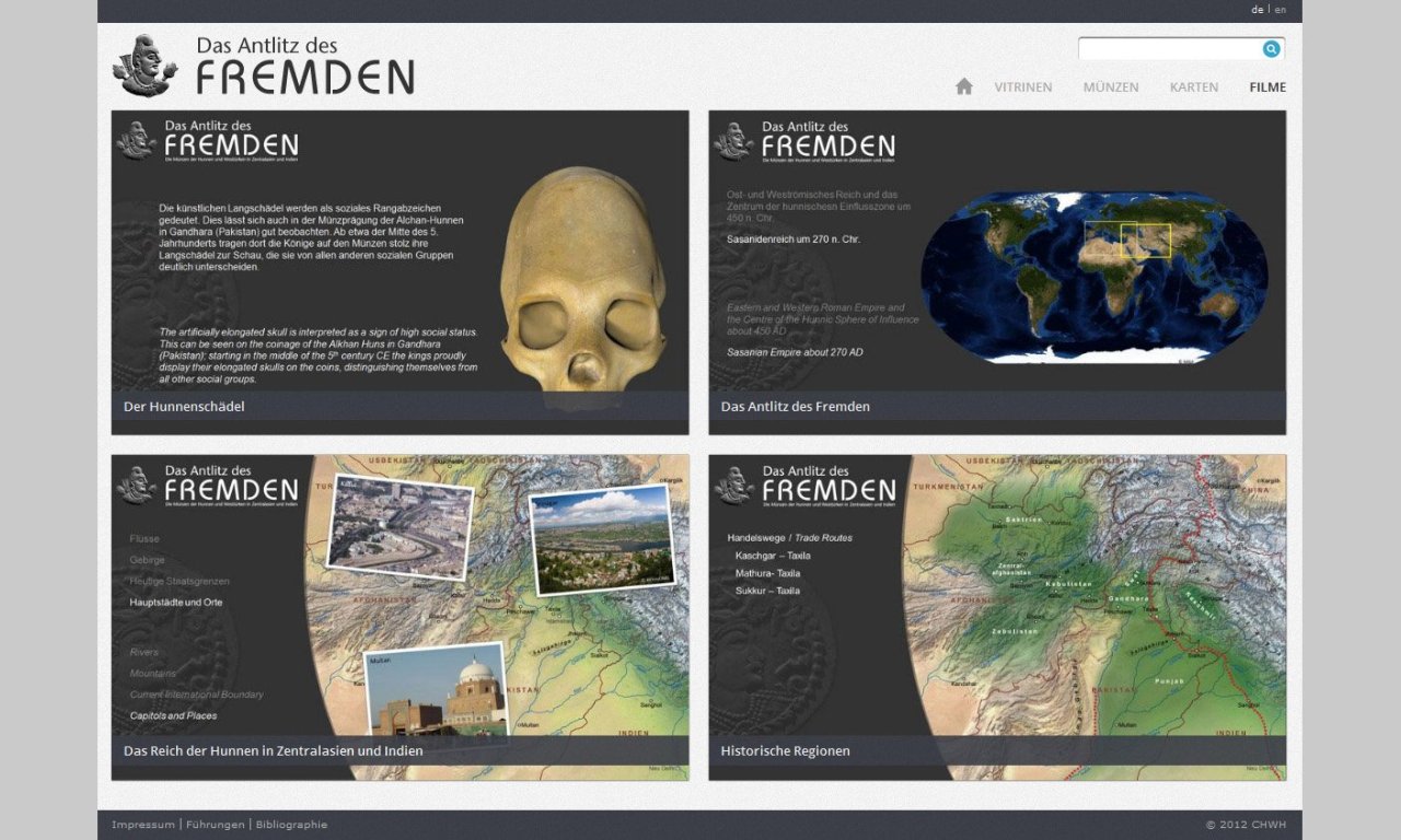
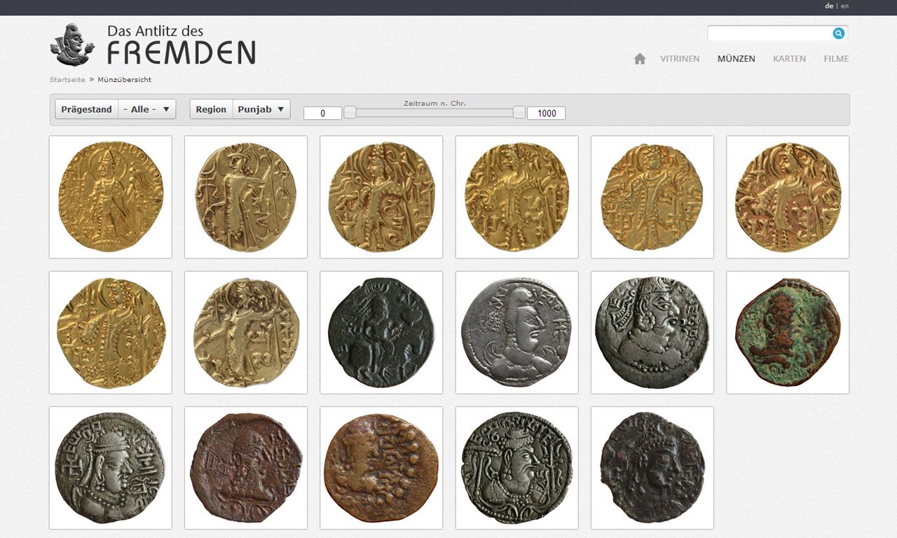
KHM Vienna - The Countenance of the Other
KHM Vienna - Coinage and Power in Ancient Israel
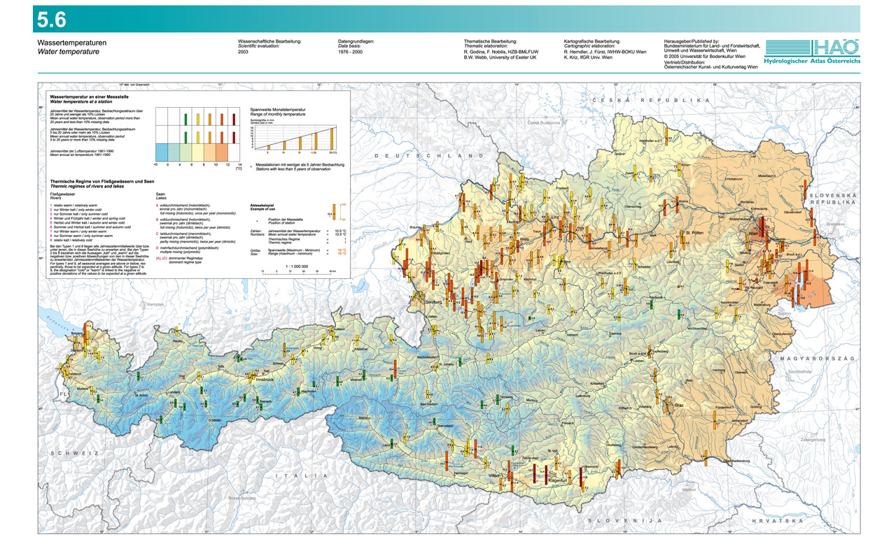
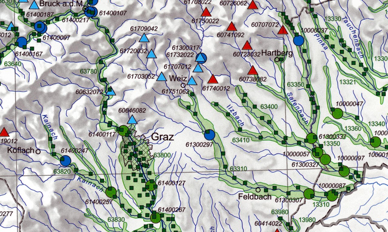
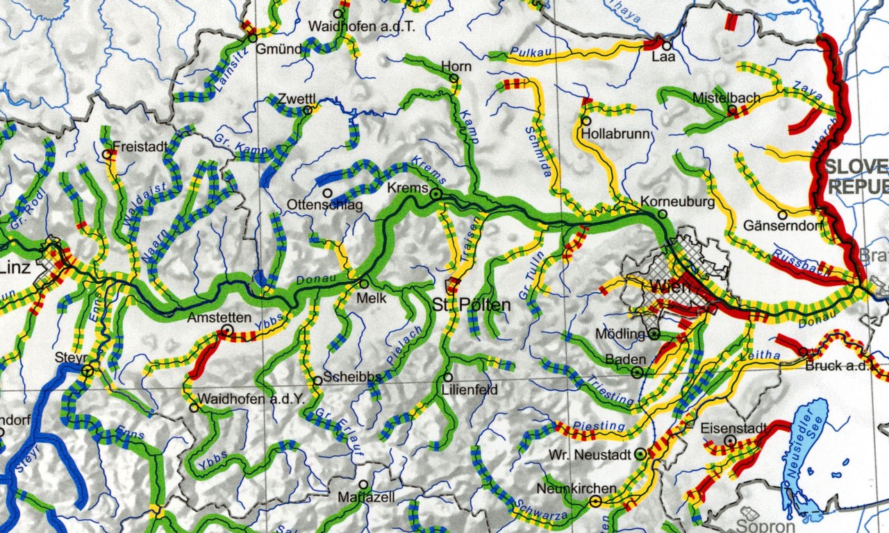
Hydrological Atlas of Austria
The Hydrological Atlas of Austria (HAA) consists of conventionally printed thematic maps and is combined with a digital, GIS-based version. Thereby, both the expectations of the traditional map users and those who prefer electronic representations are met.
A cartographic concept has been found, which on the one hand presents a homogeneous layout which gives the HAA its own identity and on the other hand enables an optimal presentation of the various topics in the atlas. The structure of the atlas covers the different components of the water cycle (e.g. precipitation, run-off, lakes and groundwater), contains various chapters dealing with water and mass balance and also covers water management themes as well as those on water and environment. The authors of individual maps represent the leading Austrian institutions in the fields of the respective topics. Thus the HAA is a true collaborative product of Austria's hydrologists.
The digital HAA is a combination of thematic maps and digital data sets, which enable the users to carry out further analysis, to query and verify and to make their own applications. The complete HAA contains 52 map sheets and 70 explanatory sheets.
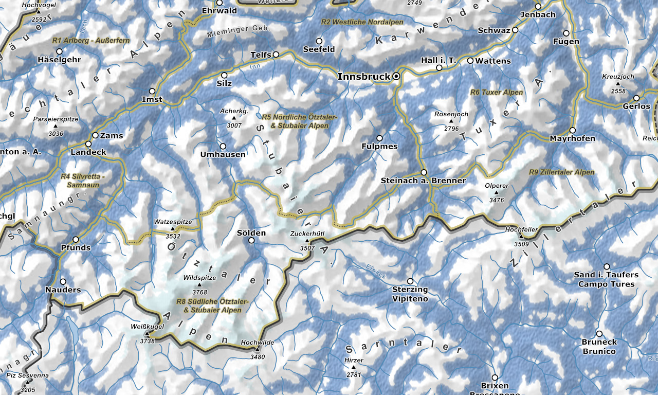
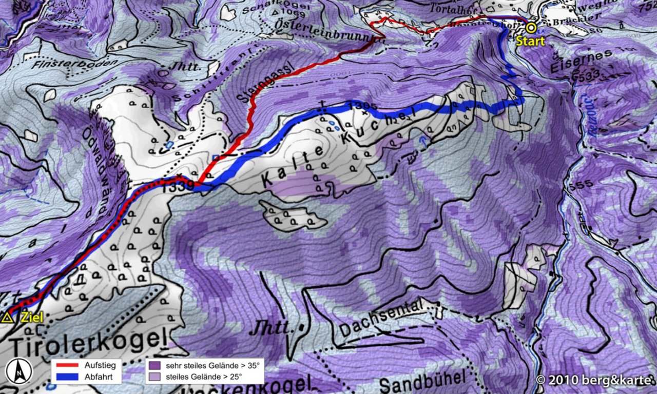
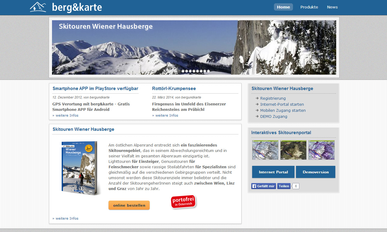
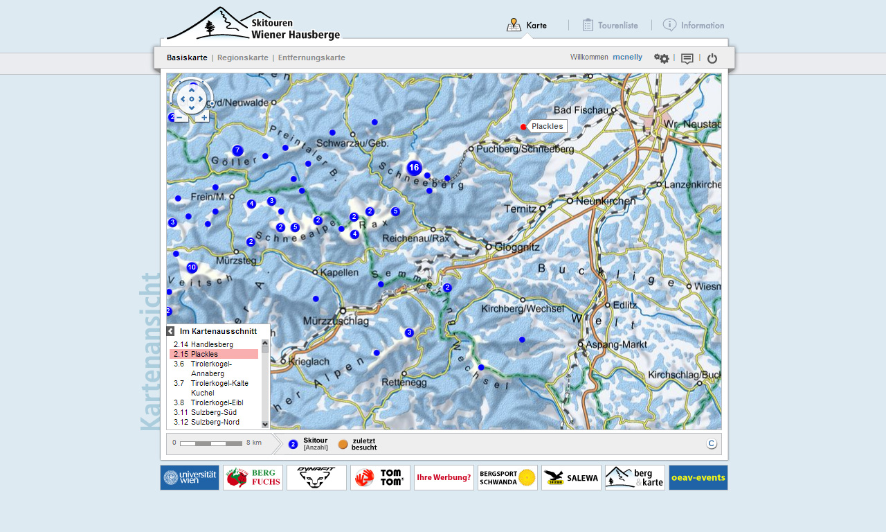
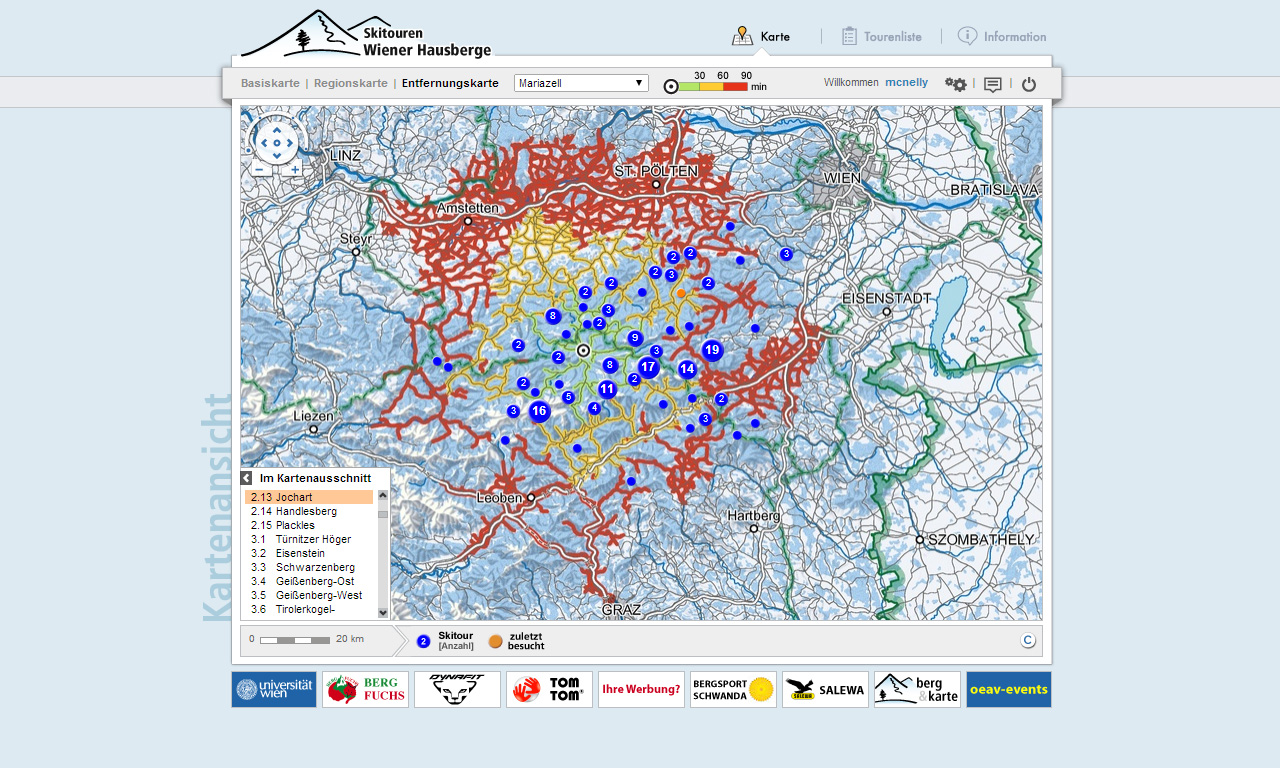
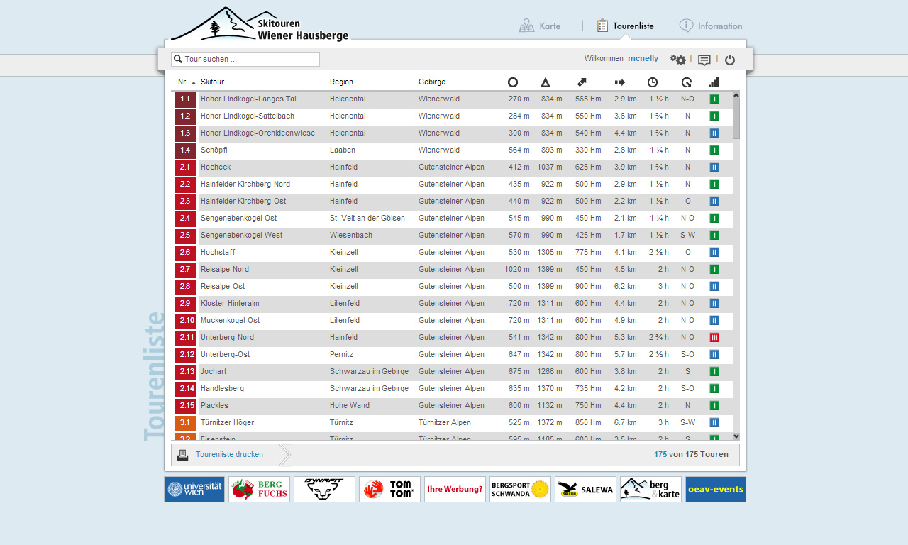
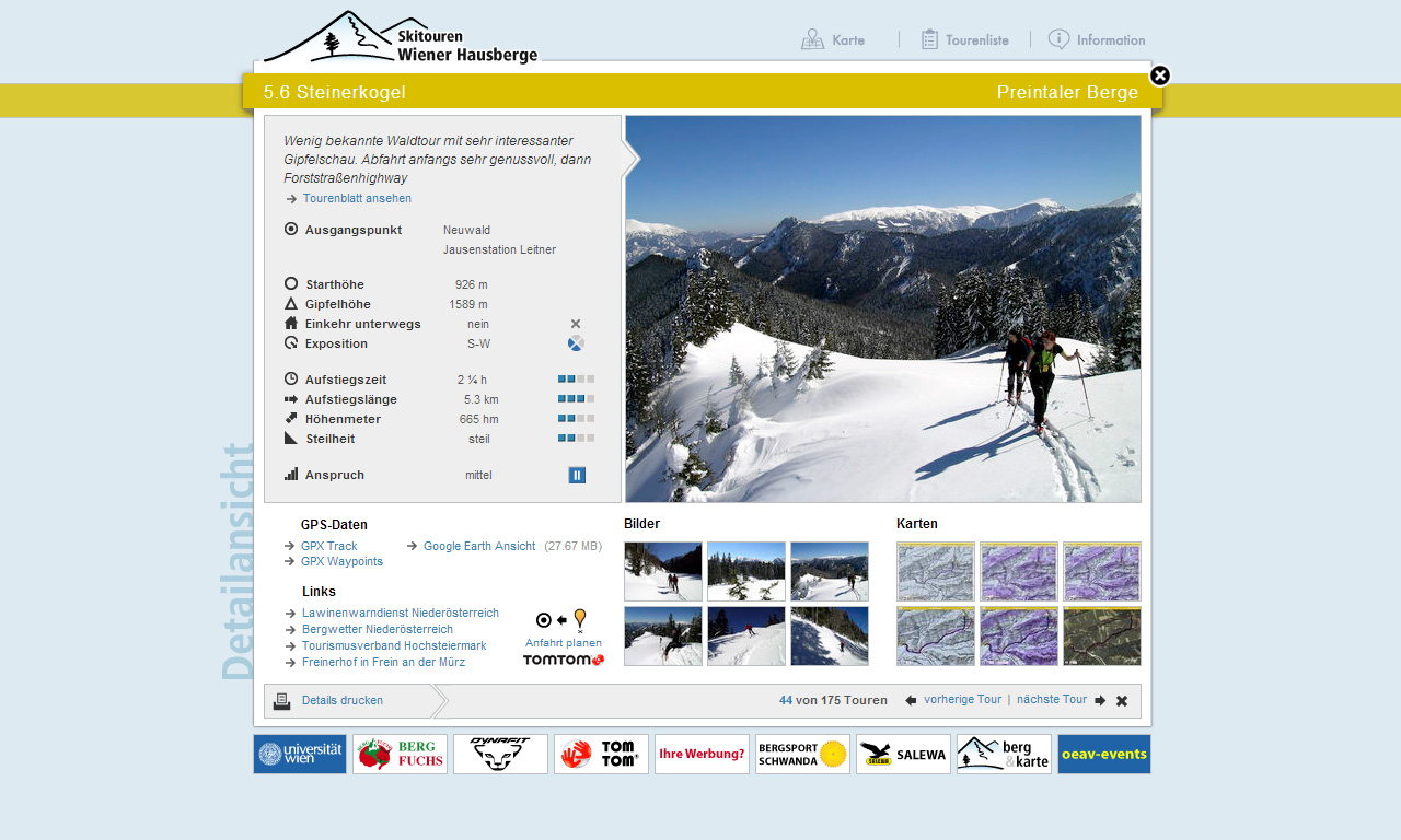
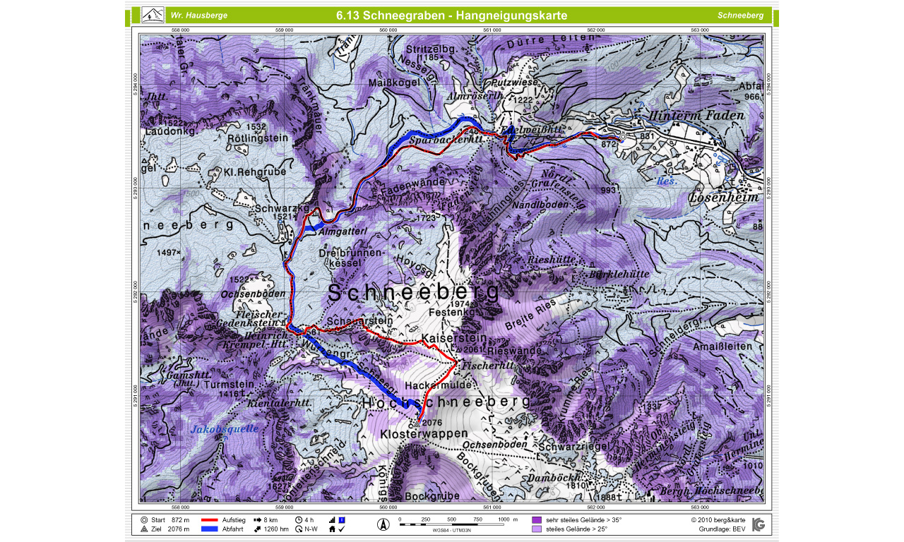
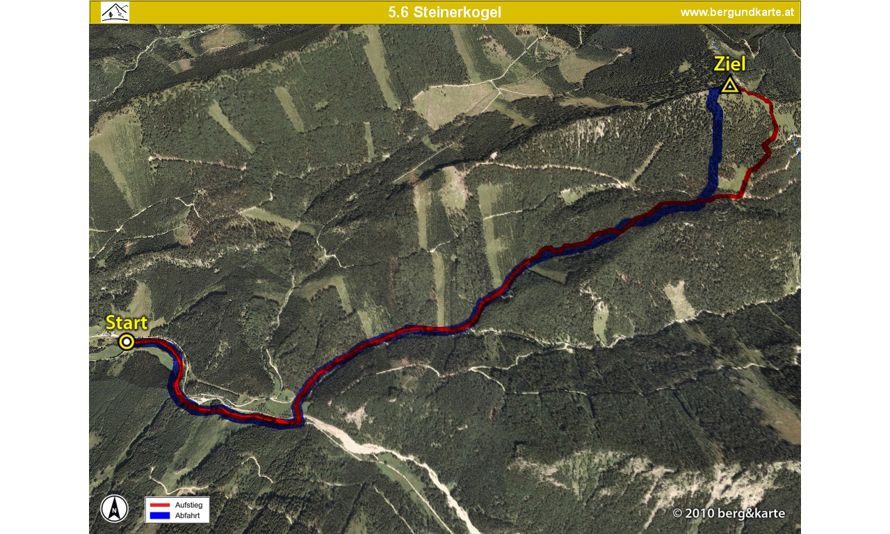
berg&karte Skitouring Plattform
Printed guide books as well as high quality large scale topographic maps have been accompanying alpinist endeavors effectively for many decades assisting the user during navigation in unknown mountainous areas. They have become an indispensable tool that developed over years utilizing technological know-how as well as advanced graphic design.
In the course this project work on utilizing cartography to enhance print, internet and mobile media was undertaken. The goal was to analyze and evaluate various approaches on how cartography can be used to assist geospatial communication based on high quality large scale topographic maps and map related depictions. One practical outcome of the project was the production of a mountain guidebook with a strong focus on cartographic communication based on print, internet and mobile access. Furthermore user logging and tracking was incorporated to analyze utilization of individual tasks. This was assisted by a detailed database driven support system that captures all user relevant interface movements for post processing analysis.www.bergundkarte.at
Mapping - Means of Communication
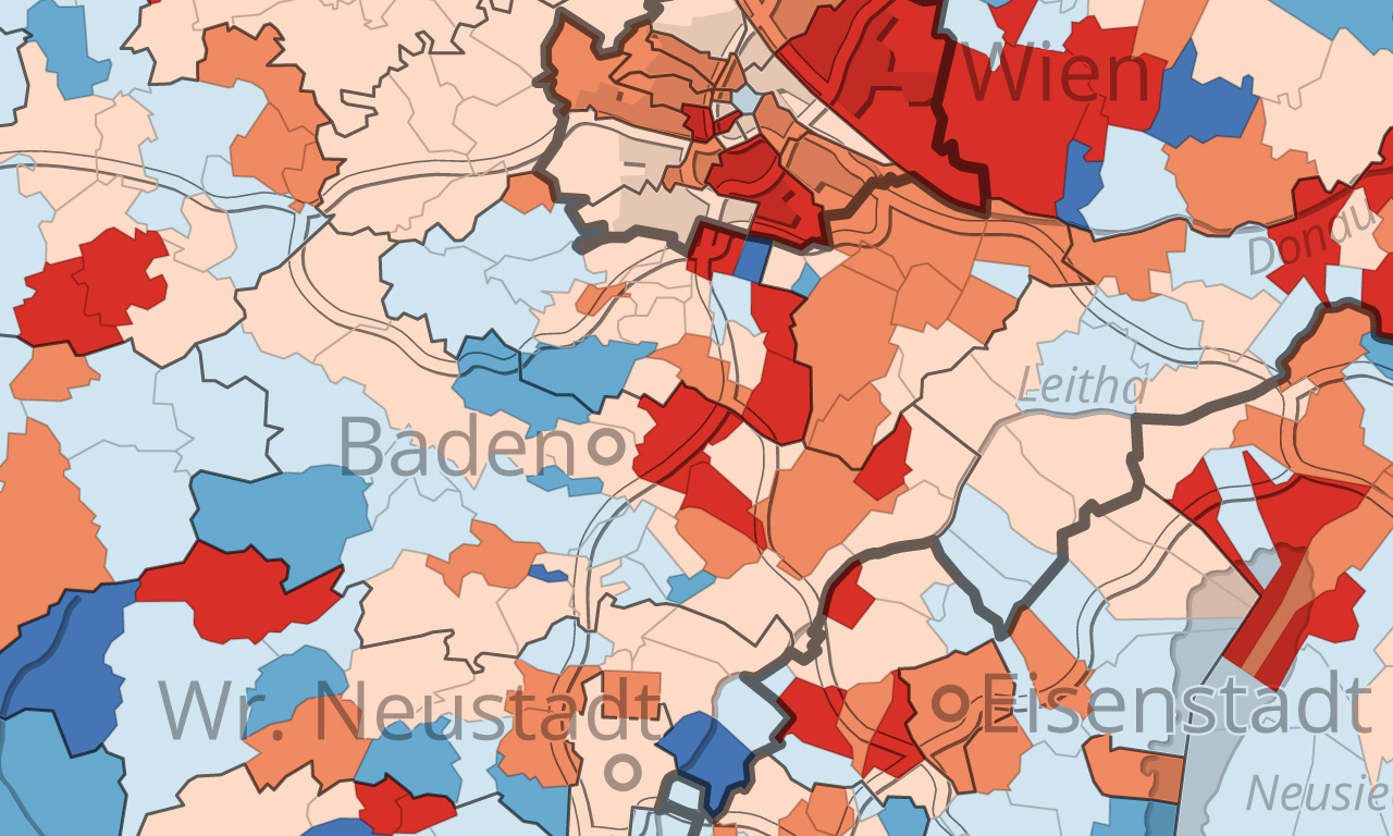
ÖROK-Atlas online
Comparing, Analyzing and Visualizing Statistical Data
WISER
Water Isotope System for Data Analysis, Visualization, and Electronic Retrieval
CHIS
Cultural History Information System of the Western Himalayas
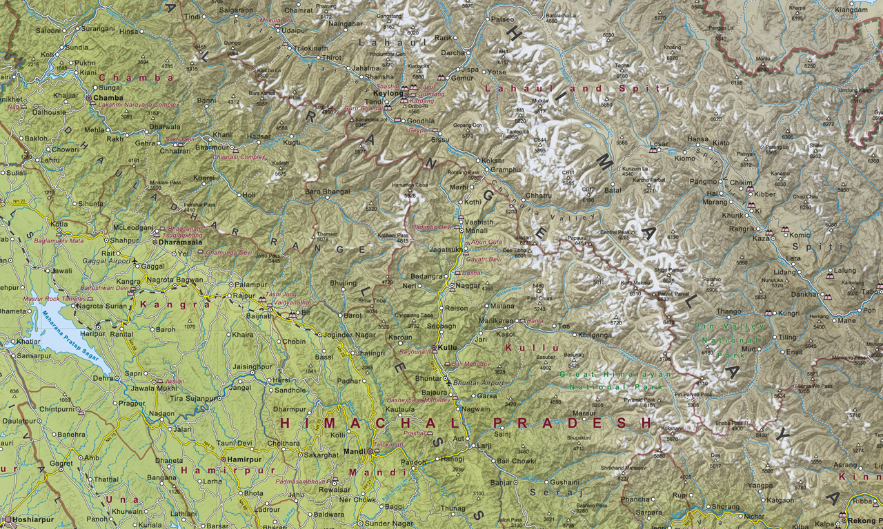
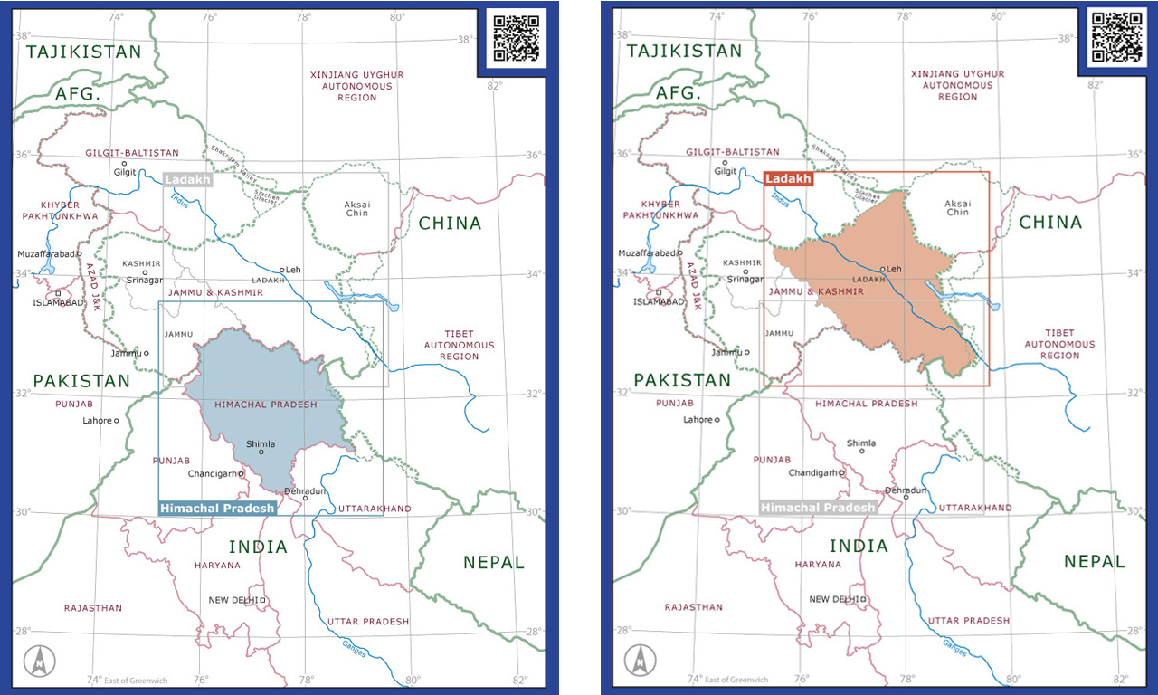
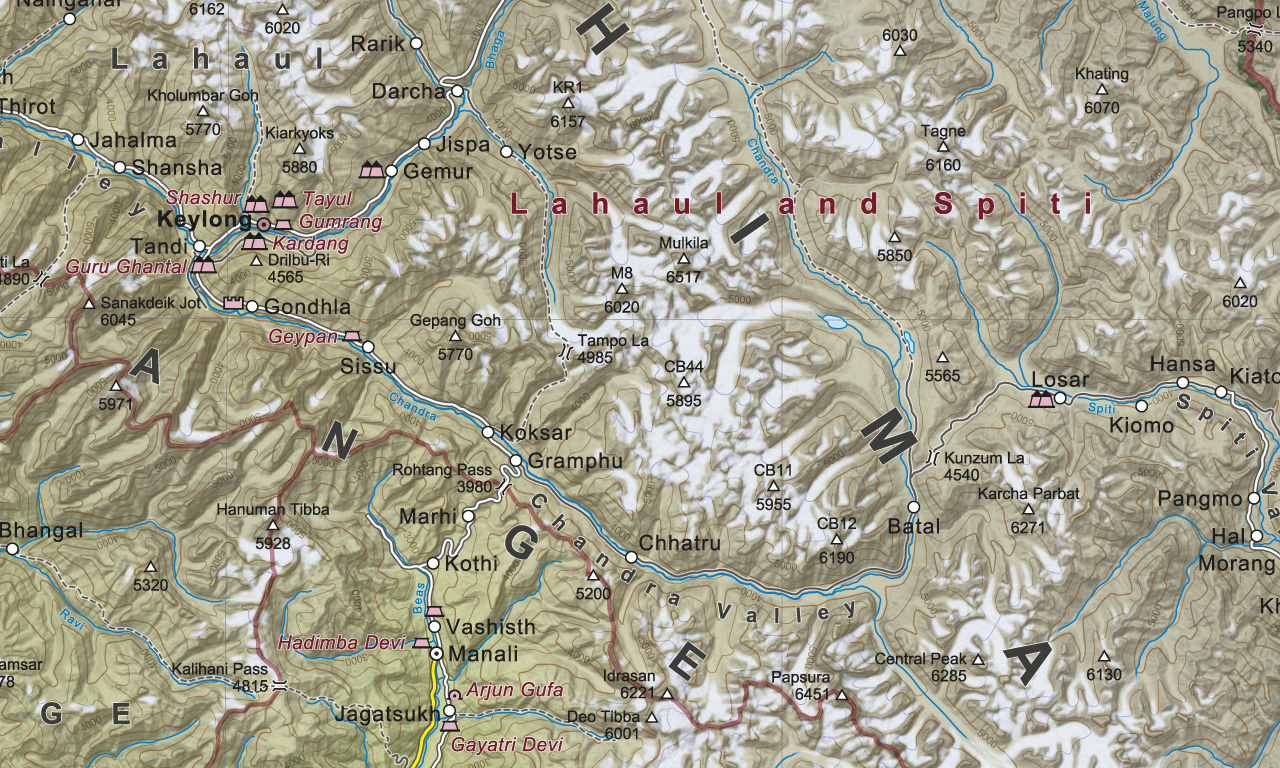
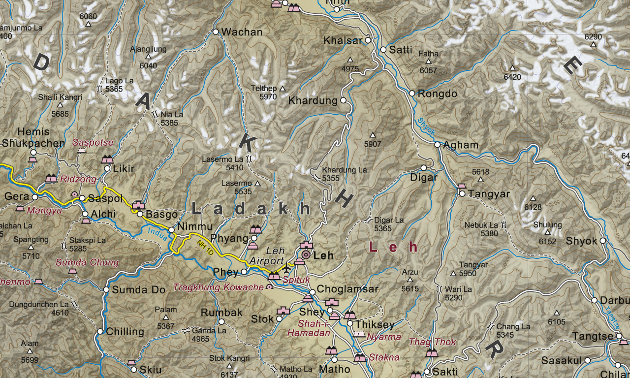
Topographic Maps 1:500.000
Himachal Pradesh and Ladakh Northern India

Hydrological Atlas of Austria
A synopsis of different hydrological topics and water management issues
Coin Exhibition
The Countenance of the Other
Coins of the Huns and Western Turks in Central Asia and India

EAWS
European Avalanche Warning Services
Mapping Avalanche Relevant Issues

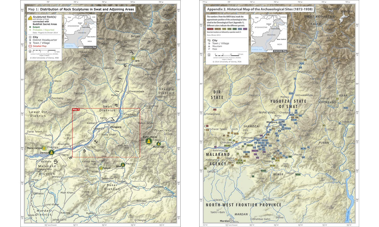
Rock Sculptures
Maps of Rock Sculptures in Swat and Adjoining Areas, Pakistan
berg&karte
Interactive Skitouring Plattform
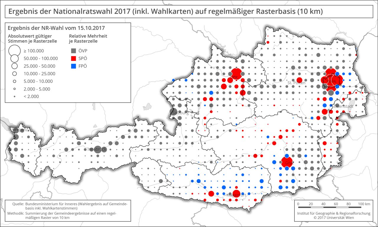
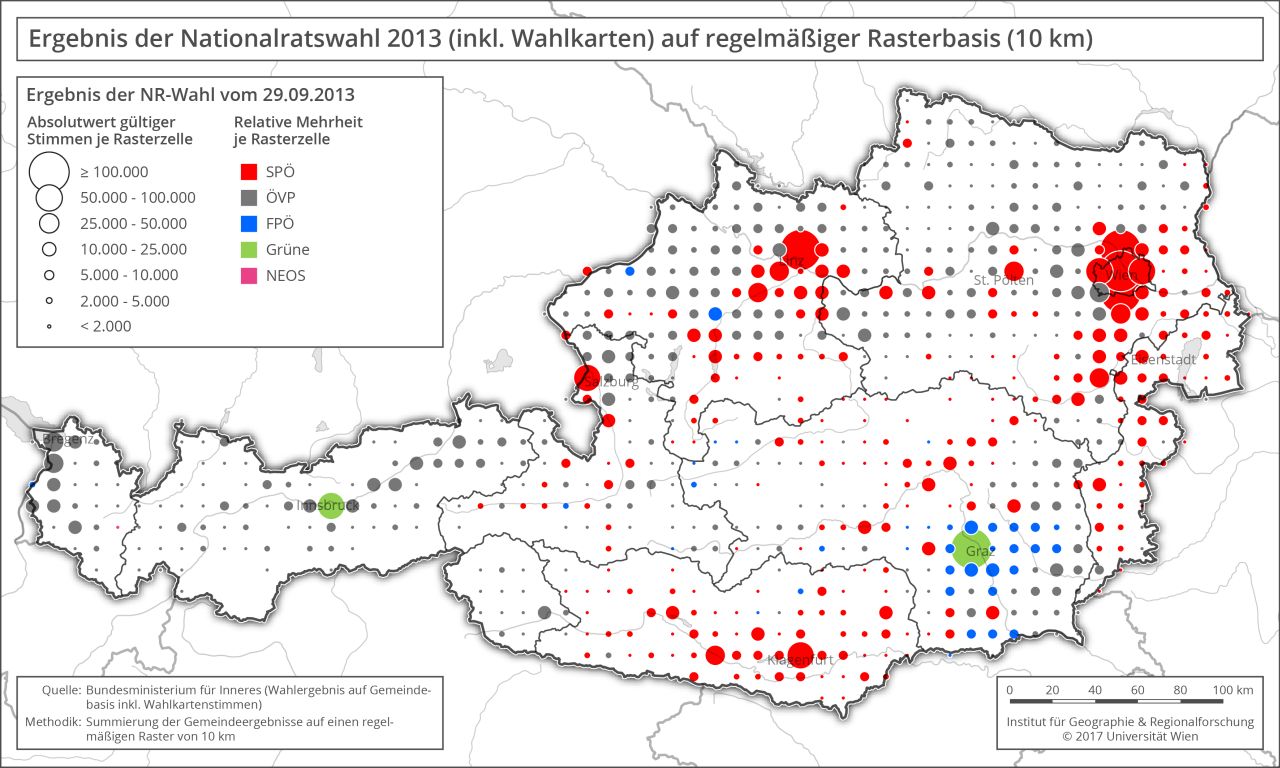
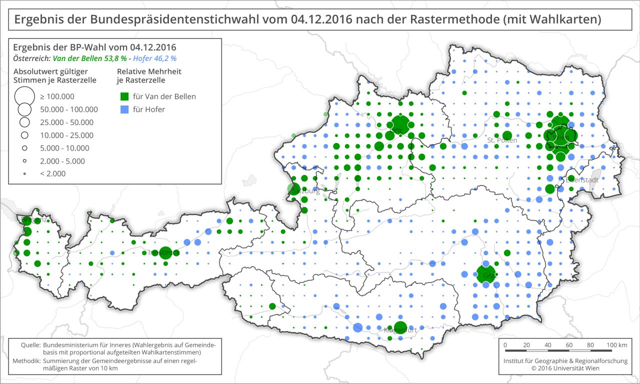
Grid Mapping
How Maps Distort the View of Reality
Contact info
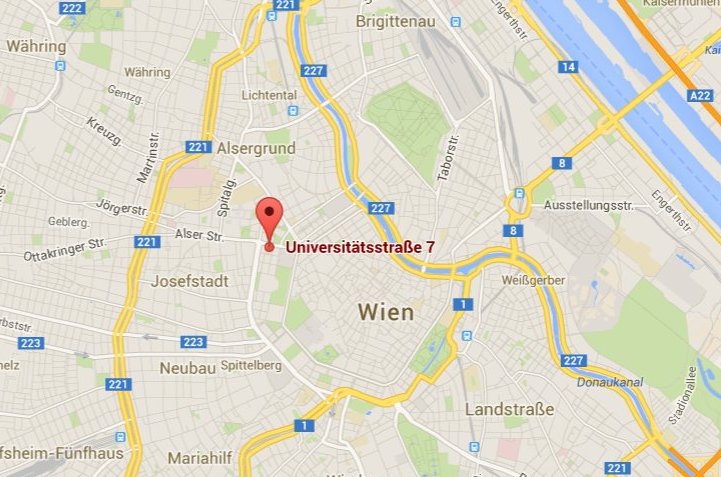
- Name: Karel Kriz
- Address: University of Vienna
Department of Geography
and Regional Research
Universitätsstr. 7, A-1010
Vienna, Austria - E-mail: karel.kriz@univie.ac.at
- Phone: +43 1 4277 48641
- Cellphone: +43 664 81 75 265